Free iphone Apps for Maps
Locate thousands of free iphone/ipad apps for Maps.
Maps FREE APPS
MapQuest 4 Mobile
By AOL, Inc. released on: 2009-06-11T07:00:00Z

Why pay for a navigation device when you can get FREE Voice-Guided, Turn-by-Turn Directions right from your iPhone? Plus, you get the same trusted directions that you've come to rely on from MapQuest.com. Millions of others have already downloaded it, so why not try it?
******************
FEATURES:
FREE - MapQuest 4 Mobile is truly a free product - there is no trial period, subscription or upgrade necessary. You get all these capabilities absolutely free!
Voice-Guided/Turn-by-Turn Navigation - Your phone speaks to you, telling you when to make a turn.
Reliable Directions - Directions powered by MapQuest, the trusted source to get you there.
iOS4 Compatible - Make a call or listen to music while MapQuest continues to tell you where to go.
Live Traffic - Extensive coverage that's updated every 5 minutes.
Simplified Search - Look for restaurants, coffee shops, gas stations, etc with 1-click.
Walking & Driving Directions - Choose to walk or drive and we'll give you the best route.
Auto Re-route - If you take a wrong turn, it will automatically adjust your route to get you to your destination.
Energy Savings Settings - If you're low on battery, you can switch to a high savings setting.
Other great features: Multiple stop routes, Landscape view, Customizable avatars and more!
KEYWORDS: Free app, maps, driving directions, navigation, local, traffic, hotels, restaurants, mapquest
LANGUAGES: English
REQUIREMENTS: Compatible with iPhone"u00ae and iPod touch"u00ae Requires iOS 3.0 or later. Please Note: GPS features require an iPhone with GPS functionality. Continued use of GPS running in the background can dramatically decrease
battery life.
WHERE
By WHERE, Inc. released on: 2008-07-11T07:00:00Z

Discover your next favorite placeon WHERE!
- Get personalized recommendations for places you'll love
- Find 'Perfect Places' for you and a friend to go together
- Discover 'Perfect Places' on the go by bumping phones!
- Find exclusive deals from local businesses
- Stay connected with your favorite places
Join more than 4 million people who rely on WHERE everyday to answer the question, 'Where should I go next?'
* Known issue: If you are experiencing issues when upgrading from a previous version, such as being stuck on one page, please delete and reinstall the app. Sorry for the inconvenience.
Loopt
By Loopt, Inc. released on: 2008-07-11T07:00:00Z

Life just got more interesting. Loopt is the best way to see what's happening around you - which friends (from Loopt and Facebook) are nearby, which bars are hopping, and which restaurants your friends like to go to. Use Loopt's free location-aware text messaging ("Ping") to connect with friends, and find places to go, when you're out and about.
* See where your friends are right now, including Facebook friends who use Facebook Places to check in.
* Get alerted when friends are nearby, so you can get together.
* Ping your friends -- send free instant location-aware texts to friends to find out where they are so you can get together.
* Discover places your friends like to visit nearby.
* Get alerted about "hot" places where your friends are gathering right now.
* Update your friends with messages and photos, and instantly share to Facebook and Twitter.
* Automatically share your location with a subset of close friends/family all the time, without checking in. (Everyone else will see you only when you choose to check in.)
YP - Yellow Pages for iPhone
By YELLOWPAGES.COM LLC released on: 2008-07-11T07:00:00Z

Need a cup of coffee, want to find a good pizza place in town? Like to read reviews before choosing a restaurant? How about access to coupons at your finger tips - providing you with discounts to your favorite locations? The YP app is your easy-to-use guide for local info and discounts near you. Download the YP app now!
Use your YP app to find what you're looking for fast. Type, speak, or browse over 18 million business listings including restaurants, bars, hotels, doctors, pharmacies, mechanics, salons, plumbers, taxis, ATMs, and more.
View comprehensive business details such as phone numbers, addresses, open hours, ratings, reviews, and even movie showtimes. The YP app's helpful integrated maps and driving directions use the iPhone's current location feature to deliver accurate directions and maps.
NEW! Ever find yourself clipping coupons and then forget to bring them to the store? The YP app lets you browse, save, and redeem local deals right from your iPhone*.
5 Stars - "I always find what I need. Much better than other sites especially since its free!- Simonsayshey **
5 Stars - "Great for finding stores, their numbers and directions. Thumbs up." - Gucci_Fi ***
Other key YP app features include:
Rate and Review - Rate and Review businesses and services right from your iPhone
Map-based search - See your results in an integrated map view
Share - Email or text listings to your friends or post to Facebook/Twitter
My Stuff - Save favorite business listings, deals, and events for easy recall
Voice search - Simply speak search term and avoid typing
History - Easily access your recent searches and viewed items
Auto-suggest - Predictive text displays suggestions as you type
Add to contacts - Quickly add key business details to your personal address book
The YP app for the iPhone is an industry leading app from AT&T, which delivers the YP local search experience to your iPhone. It is part of the YP portfolio, which includes YP.com, the new YELLOWPAGES.COM. Create your YP experience today!
* Some restrictions may apply
**App Store User Review November 12, 2010
***App Store User Review October 16, 2010
AllTrails - Trails and Offline Topo Maps for the Outdoors: Hiking, Camping, Mountain Biking, Running, Fishing, National Parks, and More
By AllTrails, Inc. released on: 2010-12-17T11:35:17Z

AllTrails is THE app for finding trails nearest you.
Going on a trip to a national park? Looking for a place near home to hike or run? Looking for something new to do on the weekends?
Even in a big city you might be surprised by how much nature surrounds you.
Browse through over 40,000 high-quality trail guides for outdoor activities including everything from hiking and mountain biking to fly fishing and snowshoeing.
FEATURES
Browse trails closest to you
Search for specific trails
Read and write trail reviews
View topographic maps and routes* for trails
Share trails with friends
Access your trails without an internet connection (Before you head out, save a trail to download its maps, photos, and reviews for offline use)
Sync your saved trails with your account on AllTrails.com
Go out and rediscover the outdoors!
*Routes are currently only available for about 2,000 of our more popular trails. Stay tuned for our next major version!
---
COMPATIBILITY
Offline topo maps and trail routes require iOS 4.0 or greater.
An internet connection is required to download the initial batch of trails.
Trails currently only available in the U.S., Canada, and Puerto Rico.
SUPPORT
Please feel free to email us at iphone-support@alltrails.com for support, issues, or feature requests.
GateGuru - featuring Airport Maps
By Mobility Apps LLC released on: 2009-12-02T03:02:29Z

GateGuru - Revolutionizing the Airport Experience Since 2009.
GateGuru is the leading day-of travel application that covers over 115 airports across the United States, Canada and Europe. We have created GateGuru to serve as a valuable resource from the minute you leave on your day of travel to the minute you arrive at your destination. The application allows you to view your Tripit and KAYAK itineraries, view / post airport security wait times and see a structured list of airport food, shops and services - including over 20,000 reviews and tips and 4,000 photos from fellow travelers on airports, terminals, and airport amenities!
****************************************************************
Featured by Apple in the television commercial "Family Travel" and in print ads "The Ultimate Carry-On". Recommended by the NYTimes (Practical Traveler), WSJ, Lifehacker, TUAW, Orbitz, Gadling, American Airlines Magazine, and many others
****************************************************************
GATEGURU UNIQUE FEATURES:
- Most comprehensive and accurate listing of airport amenities.
- View TripIt or KAYAK flight details
- Add or view airport security wait times
- Clean and uncluttered airport maps
- Access to real-time ratings, reviews, tips and photos on airports, terminals and amenities
- Quickly sort amenities by rating or location to find the BEST option for YOU
- Simple search engine
- Bookmark function for airports and amenities
- High Flyers leaderboard
- Social media sharing (Facebook, Twitter, foursquare and Gowalla) to keep your network posted on your airport travels
For additional information and/or support, please feel free email us at support@gateguruapp.com. All emails will be responded to within 24 hours.
Yandex.Maps
By Yandex LLC released on: 2009-05-13T07:00:00Z

With the mobile Yandex.Maps application, you will be able to:
- find pharmacies, caf"u00e9s, banks, hotels and other locations in any area;
- make your own contribution to your city's traffic map using a GPS device;
- accident, speed camera and roadwork locations are marked on the map. You can also confirm or dispute existing hazards on the map.
- build the best possible traffic route taking into account traffic conditions in Moscow and Moscow Region
- change the display mode: if you select the map rotation mode, you will always move forward and the map will rotate around you.
There are no data charges for MegaFon Russia, MTS Russia and Beeline Russia customers using this app
History:Maps of World
By Seung-Bin Cho released on: 2009-02-06T12:18:31Z
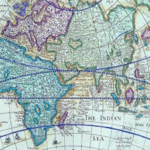
"History:Maps of World" is a fun and educational collection of high-resolution historical maps.
Check it out to keep up with your history, learn something about history.
I hope you enjoy my app!
Features
- Wide variety of historical displays
- Support for Category/Era view
- Keyword Search
- Displays the source about each map
- Zoom in/out (zoom-in/out with pinch, zoom-in with double tab, and zoom-out with two-fingers tap)
- Free screen rotation
- Not require a network connection
- I have a plans to add more features and maps.
The following is a companion.
- History:Maps of U.S.
- History:Maps of Europe
- History:Maps of Americas
- History:Maps of Africa
- History:Maps of Asia
- History:Maps of Middle East
- History:Maps of Oceania
- Thematic Maps of World
- History:Today
FastMall - Shopping Malls, Community & Interactive Maps
By MindSmack released on: 2009-12-05T05:25:28Z

Now you can navigate any mall map WITHOUT the need for GPS or WIFI. Once you download any mall map you can get interactive navigation even without an Internet signal!!!
NOW AVAILABLE IN SPANISH!!!
As seen in New York Times, Fox Business News, Scobleizer, Techcrunch, ABC News, Gizmodo, LA Times, Star Tribune, NBC Los Angeles, Mashable, AdAge, Pioneer Press & 100's more. Now in 22 countries around the world.
Win a gift card at your favorite mall or store by checking in if your selected!
FastMall™ is a truly exciting, helpful interactive experience and community that allows you to find, then be guided turn by turn to restrooms, stores and restaurants at shopping malls around the world all without using GPS or WIFI.
Remember where you parked your car, add a text, photo or video review of anything you would like and share it with the world, check in at the mall or stores you love and of course shake your iPhone to locate and then be taken to the nearest restroom!
Use a baby stroller? Use a wheelchair? FastMall™ allows you to select ELEVATORS ONLY as an option so you can easily get around the mall!
50+ features.
All of the largest shopping malls in the US, UK, Canada, France and more with full interactive map directories to navigate through, turn by turn.
Many new malls just added, check FastMall.com and click malls.
Want your mall added? Let us know and be a part of the fastest growing iPhone shopping community in the world.
AccuTerra - On Demand Maps & GPS Tracker
By AccuTerra by Intermap released on: 2009-09-04T01:33:00Z

ACCUTERRA 4.1 UPDATE: ALL NEW RECREATION MAPS__FULL U.S. HD MAPS AVAILABLE*__REDESIGNED UI_LITE VERSION with FREE ON-DEMAND TRIAL
AccuTerra On-Demand is your one-stop GPS outdoor recreation app with terrain, trail, and ski area maps designed for the iPhone, encompassing over five million square miles. These are not shrunken USGS maps that were made to print in 2 foot paper sheets; AccuTerra HD maps are TRIPLE the zoom level and contain the most recent trail and public land data available, optimized for your iPhone. Comparable recreation maps for expensive dedicated GPS units can cost hundreds in additional fees - AccuTerra gives you access to millions of square miles at a fraction of the price.
PLEASE NOTE!! AccuTerra is an "In-App" storefront with premium (paid) products for sale within it. The app is free to download and provides a free on-demand AccuTerra sample of over 100 square miles. If you like your free maps, you may then buy access to the rest of your state for a very reasonable price.
Maps are quickly downloaded and stored into the device's memory - select Grid mode to get ~50 square miles at a time of your free sample maps. Once you've tried your sample data, select your whole state for one low price. Or choose from over 350 defined recreation areas in the AccuTerra catalog. AccuTerra provides an accurate GPS location, on beautiful color maps, wherever you have clear line of sight to the skyeven if you're hundreds of miles from the nearest cell signal. Choose from over 220,000 miles of trails, thousands of trailheads, campgrounds, picnic areas — it's the ONLY app available that displays all major public land boundaries.
Here's the Buzz:
"Bottom line - if you have an iPhone and you hike, you should download AccuTerra." -ModernHiker.com
"The best GPS app for outdoor enthusiasts... because it works without a wireless connection." -AppStruck
"Anyone who has read "u2018Into the Wild' will understand why AccuTerra for iPhone is an amazing and possibly lifesaving service."
-Read Write Web
"There's something very satisfying about zooming in and out, and scrolling around all without waiting for the images to load. It is completely instant. Fantastic."
-148Apps
"AccuTerra provides geologically accurate maps with relief data and other details that Google Maps doesn't provide.""t
-VentureBeat
"I've been waiting a long time for something like this to come out."
- YourNextApp.com
"AccuTerra is ideal for biking and hiking enthusiasts"
-GigaOM
AccuTerra Unlimited Features Include:
"u25c9 Unlimited Tracks! There is no limit to the number of hikes/tracks that can be recorded.
"u25c9 Unlimited Waypoints! There is no limit to the number of geo-located points that can be recorded.
"u25c9 Unlimited Geo-coded pictures! Photos taken within AccuTerra UNLIMITED are linked to your adventures and can be displayed in the location in which they were taken.
"u25c9 Real-time elevation profile and travel statistics.
"u25c9 Easily toggle and track between AccuTerra Maps and Google Maps™
"u25c9 Share your adventure. Upload directly from AccuTerra into your Facebook™ account, or send your tracks and photos via an email link for viewing in Google Maps™ or Google Earth™
Have a question, comment, request or criticism? We listen to our customers - hit us up at www.twitter.com/accuterra
* U.S.A. HD coverage is the contiguous United States (the "u2018lower 48') and does not include Alaska. Our apologies to Alaska and its visitors -the cost to produce maps is prohibitive; it's just too darn big and most of it is remote. We hope to include the great state of Alaska sometime in the future.
Ski Area Data is provided through SnowRanger™ by Mountain Dynamics. Intermap Technologies and Mountain Dynamics are not affiliated with any ski area operator.
NOTE: Continued use of GPS running in the background can dramatically decrease battery life.
Disney World Maps Free
By VersaEdge Software released on: 2010-10-08T07:00:00Z

Interactive maps with wait times, GPS, zoom, search and photos make it easy to navigate the parks and find restaurants, bathrooms, and attractions. Covers Magic Kingdom, Epcot, Hollywood Studios and Animal Kingdom.
★★★★★ ALSO AVAILABLE WITHOUT ADS
The paid version without ads has more viewable space. Search for VersaEdge to find the paid version.
★★★★★
FEATURES
"u2713 Interactive guide maps for Disney World parks viewed in portrait or landscape orientation
"u2713 Wait Times on the map shared with the Disney World Wait Times app
"u2713 Your GPS Location on the map
"u2713 Zoom in to see attractions, restaurants and bathrooms
"u2713 Zoom out to see park layout
"u2713 Search for an attraction or restaurant by name
"u2713 Select a map item to see photo and information
"u2713 No network connection required except for Wait Times data
"u2713 Supports iPhone, iPod Touch, and iPad
Visit VersaEdge.com for more info and demo video.
Try our other Disney apps such as Disney World Dining or Disney World Park Hours. Search for VersaEdge or click on VersaEdge Software in iTunes.
iTrailMap (Ski and Snowboard trail maps)
By Big Air Software, LLC released on: 2008-12-19T07:40:08Z

Download high resolution trail maps of your favorite ski and snowboard resorts. Unlike most snow report apps, you can use the maps WITHOUT cellular service. The maps are downloaded and stored on your iPhone or iPod touch.
View maps in portrait or landscape mode.
Piste Maps of over 750 resorts currently available. See the website for a full list.
Best of all.....It's free!!!!!!
For GPS tracking and 3D maps of the ski resorts, check out iTrailMap 3D. It is also available on the App Store.
Skiing, snowboarding, cross country, hiking, we got you covered.
QuakeFeed - World Earthquake Info Displayed on ESRI Maps
By Artisan Global LLC released on: 2010-11-30T06:35:46Z

Most features of any free earthquake app! Six different basemaps provided by ESRI. Past 7 days of earthquakes with magnitude > 2.5, displayed on a map or in list. Variety of filter / sort options. Location aware - find quakes that are closest to you. Beautiful UI - check out our screenshots! Twitter, Facebook, and email integration.
BASIC FEATURES
*All world quakes > 2.5 magnitude for past week.
*Quakes displayed in a list or on a map.
*Drill down to quake details view:
---Map zooms to quake location
---Magnitude, time, lat/long, distance, depth
---Link to quake details on USGS website
* Social media integration - share via:
---Facebook
---Twitter
---Email
INTUITIVE USER INTERFACE
*Map symbols color-coded / sized by magnitude.
*Quake list color-coded by magnitude.
*Sort list by date, magnitude, or distance from current location.
*Filter list or map by magnitude.
*Specify units for distance (km or miles).
*All screens work in portrait or landscape mode.
ENHANCED MAPPING CAPABILITIES
*Six different basemap options:
---Street Map
---Satellite Imagery
---Shaded Relief Map
---Physical Map
---Terrain Map
---Topographic Map
*Pinch to zoom / drag to pan.
*One touch zoom in / two touch zoom out.
SUGGESTIONS? QUESTIONS?
Contact us at support@artisanglobal.com or visit http://quakefeed.net -- we appreciate your feedback!
Offline Topo Maps
By TrailBehind released on: 2010-06-12T03:07:59Z

Offline Topo Maps is now totally free. Compare the functionality, speed, and ease-of-use of Offline Topo Maps to any paid topo app.
Offline Topo Maps helps you find your way even when you aren't connected. The app provides topo and road maps, as well as features useful for hiking, camping, biking, and other outdoor sports
* download maps of the entire world
- detailed MyTopo maps covering US/Canada
- international CloudMade shaded relief and road maps
- OpenStreetMap road maps
- CloudMade international cycle/topo maps
* mark waypoints and get guidance to and from places
* use metric, imperial, or nautical units
* display coordinates in Decimal, UTM, MGRS, DMS, or Decimal Minutes
* fully auto-rotatable for widescreen maps and other views
If you like Offline Topo Maps, also try Gaia GPS, our full-featured outdoor GPS app. You can try the free version, Gaia GPS Lite, and upgrade to the paid version if you like it. Gaia GPS includes many more features, such as GPS tracking, an extensive POI database, GPX imports, and more.
Disney World Wait Times, Dining and Maps Free by Undercover Tourist
By Phunware Inc. released on: 2010-08-08T08:40:30Z

* Created from the Paid, Fully-Featured Version Recently Showcased in Frommer's "Budget Travel" as "Fun for the Whole Family" (July / August 2010)
* Named "Best App for Taking on Walt Disney World" by Fox News
* Based on our Multiple Time # 1 Top Paid App (Travel), # 1 Top Free App and Top 60 Free App (Overall)
FREE VERSION HIGHLIGHTS
. Compelling look and feel, with high resolution retina display and graphics.
. Disney Dining, including Theme Park restaurants and full menus.
. Theme Park opening hours, parade times, status and other special events.
. Detailed Wait Times, including not only accurate estimates, but also graphical time overlays directly on the maps as well.
FEATURES & DESCRIPTIONS
. Detailed Maps and GPS Locator - Enjoy accurate wait times, integrated in real-time, with park maps for Walt Disney World's Magic Kingdom, Epcot, Disney's Hollywood Studios and Disney's Animal Kingdom. All of these locations can be found in just one App!
. Real-Time Data Points - Save time with over 2,000,000 wait time data points, all enhanced by real-time user submissions.
. Rides - Pre-plan with detailed information, including photos, descriptions, ratings and height / age requirements. The App filters the rides by age, family and Fast Pass.
. Disney Dining - Cruise through menus for Disney World. Restaurant ratings, cuisine, cost and photos are also at your fingertips.
. Traffic Light System - You can choose the best parks and rides with the lowest crowds for each day of your trip.
. GPS Tools - Locate rides, restaurants and yourself on the map easily and quickly.
. Functionality - Full functional with any iPhone having network coverage, including offline capabilities for iPod Touches, including full maps and ride information.
Undercover Tourist, the trusted name in attraction tickets, is contracted, licensed, and officially authorized by Walt Disney World and other attractions (including Universal Orlando, SeaWorld Orlando and the major dinner shows) to sell discounted tickets that are new and genuine.
Continued use of GPS running in the background can dramatically decrease battery life.
The Undercover Tourist Free App is not an official App of Walt Disney World.
Gaia GPS Lite - Offline Topo Maps, Compass, and GPS Tracking for Trails - Hiking, Biking, Skiing, Camping, Running
By TrailBehind released on: 2009-10-07T11:50:31Z

Off-trail, road-tripping, or wandering abroad? Use Gaia GPS to navigate anywhere you aren't connected.
Gaia GPS is a full-featured outdoor GPS app, developed by Anna and Andrew. We wander around with our dogs and like to pitch our tent wherever Gaia leads us. Please email us with questions, bug reports, feature ideas, and other feedback at gaia@gaiagps.com.
The lite version has three differences from the paid version:
The lite app includes ads and an Upgrade tab.
The paid app can import GPX files.
The paid app includes a Map Store where you can get additional free and paid map sources, such as snowmobile trails, Florida satellite imagery, and more.
Gaia lets you:
Download maps for times when you don't have an internet connection.
View topographic and road maps. Use MyTopo maps in the US/Canada, and Cloudmade topo and road maps all over the world.
Record tracks, waypoints, and take geo-tagged photos.
Search for nearby waypoints and reports about places.
Import and export GPX files, by email or to EveryTrail.com.
Customize all aspects of Gaia, including units, coordinates types, color and sound, and more.
"u25ba"u25ba IMPORTANT - IPOD TOUCH AND NON-GPS IPHONES This application will not be fully functional on these devices. The GPS Recorder and compass will be inactive. You will be able to view maps and waypoints, but you cannot record tracks.
"u25ba"u25ba GPS WARNING - Continued use of GPS running in the background can dramatically decrease battery life.
Disney World Park Maps by MyAppleSin
By MyAppleSin released on: 2010-09-22T11:57:23Z

#1 Free Travel App in Paraguay and Panama - October 2010
Don't ever get lost again! Navigate easily around Orlando (Florida) Walt Disney Parks.
Featuring:
- Detailed Maps of all Disney Parks: Magical Kingdom, Epcot, Hollywood Studios , Animal Kingdom, Blizzard Beach, Typhoon Lagoon and Downtown Disney.
- No network connection required. No wi-fi needed.
- Simple to use.
- Compatible with iPhone,iPad and iPod.
Easy to use! A Handy application that saves your time...and it's free!
City Maps 2Go - Lite
By Ulmon Solutions released on: 2010-12-19T07:58:19Z

Pick one of over 3,000 maps in 150 countries (incl. 700+ US maps). Including GPS, in-map search, Points of Interest, and bookmark functionality. AND native iPad Version!
★★★ Your favorite map - for free and with no limitations! ★★★
★★★ Highest rated Offline Map App in the Store ★★★
This Lite Version offers:
"u271a one free map download
"u271a full functionality, free, no time limit
"u271a ads on some screens
"u271a native iPad version included
City Maps 2Go is the perfect Offline-App for travelers and people on the move! Ideal for iPod Touch, iPad and iPhone, with no or bad network coverage, or when abroad. No roaming charges. No network or WiFi required! Have the whole map and POI of a city with you, any time, anywhere. Getting around in a city has never been so easy and so much fun!
★★★ Top Features ★★★
"u271a Download and view map offline, without an Internet connection
"u271a Find your location with GPS (iPhone + iPad 3G)
"u271a Search street names and points of interest in offline mode
"u271a Turn the map in viewing direction (iPhone 4, 3GS + iPad 3G)
"u271a Bookmark or pin places of interest
"u271a Add your own pins (tap and hold for 2s)
Once the map is downloaded to your iPhone/iPod, you will no longer need an Internet or WiFi connection. You will avoid inconveniences when travelling by using the maps anytime and everywhere you want - in your hometown or on the road!
More than 3,000 city maps are available. And we are adding new ones daily. Additionally, the App includes maps for holiday destinations like the Canary Islands or Hawaii. Visit our website for a full overview of available maps.
Examples of international maps: New York, London, Paris, Berlin, Hong Kong, Bejing, Munich, Rome, Barcelona, Singapore, Cologne, Bangkok, Vienna, Hamburg, Amsterdam, Venice, San Francisco, Milan, Shanghai, Los Angeles, Copenhagen, Zurich, Dusseldorf, Cairo, Toronto, Buenos Aires, Oslo, Frankfurt, Dubai, Istanbul, Florence, Lisbon, Prague, Tokyo, Brussels, Sydney, Manila, Seoul, Miami, Madrid.
Map data and POI are provided by the wonderful OpenStreetMap project. Similar to Wikipedia, this data is user-generated and offers far more information than simple street maps. To see the quality of the map data and POIs, visit: www.openstreetmap.org.
PLEASE NOTE: You require a WiFi connection once, when downloading the map. The download cannot be done via the cellular network. After downloading the map to your device, you won't need any connection anymore.
New maps are constantly added to the application! Missing a city? Need a larger map? Mail us: support@ulmon.com we can help you within days.
Disneyland Maps Free
By VersaEdge Software released on: 2010-09-25T06:49:06Z

Interactive maps with wait times, GPS, zoom, search and photos make it easy to navigate the parks and find restaurants, bathrooms, and attractions. Covers Disneyland Park and California Adventure.
★★★★★ ALSO AVAILABLE WITHOUT ADS
The paid version without ads has more viewable space. Search for VersaEdge to find the paid version.
★★★★★
FEATURES
"u2713 Interactive guide maps for Disneyland parks viewed in portrait or landscape orientation
"u2713 Wait Times on the map shared with the Disneyland Wait Times app
"u2713 Your GPS Location on the map
"u2713 Zoom in to see attractions, restaurants and bathrooms
"u2713 Zoom out to see park layout
"u2713 Search for an attraction or restaurant by name
"u2713 Select a map item to see photo and information
"u2713 No network connection required except for Wait Times data
"u2713 Supports iPhone, iPod Touch, and iPad
Try our other Disney apps such as Disney World Maps or Disney World Dining. Search for VersaEdge or click on VersaEdge Software in iTunes.
Craigslist Housing Maps - CribQ
By Hug Sandwich released on: 2009-09-18T07:16:24Z
CribQ instantly shows you Craigslist housing listings on a map, lets you keep track of interesting ones, take notes, and even email in two taps using your custom template
REVIEWS:
"A complete game-changer. Completely simplifies the Craigslist housing search."
"This is the best way I know to search for an apartment by location, narrowed down to neighborhood or block!"
"This app is def a time saver!!! It's now my # 1 most used app :) Thank you for making my transition from Southern Cali to Chicago an easier one!!!"
"Very, very helpful. It's the perfect apartment search app on the go. Wherever, whenever... :)"
Features:
- Zoom into any street or neighborhood
- Create a favorites list, and "trash" uninteresting listings
- Add notes, such as "Great view" or "Open house 6pm Wed"
- Call or email directly from listing
- Filter by bedrooms, keywords, price, and more
- Email template - send your custom email in two taps
Currently supports the top 20 Craigslist cities and a few more: (if some cities are missing, force quit the application - or restart your iphone if you don't know how)
Atlanta, Austin, Boston, Chicago, Dallas, Denver, Detroit, Houston, Las Vegas, Los Angeles, Miami, Minneapolis, New York, Orange County, Philadelphia, Pittsburgh, Raleigh, Sacramento, San Diego, Santa Barbara, Seattle, Washington DC.
CribQ iPhone is the mobile version of the popular cribq.com Craigslist housing search tool.
Email support@cribq.com if you want us to add support for your city!
Here is what CribQ iPhone can do for you:
Current cribq.com users: Enter your email address and password in the Settings page of CribQ iPhone so you can view your existing favorites and notes.
Please note: CribQ relies on data sources outside of our control and we can not guarantee continued access to that data.
MotionX GPS Lite
By MotionX2122 released on: 2008-10-19T10:50:14Z
"u25b6 MotionX-GPS is for your outdoor life: Walking, Hiking, Running, Cycling, Biking, Sailing, Skiing, Flying, Racing, Geocaching.
"u25b6 MotionX-GPS shows your position and track at all times on street maps, topo/terrain maps, satellite/hybrid maps, or marine charts. Record or follow your tracks and share with a single click your position, track, trip statistics (date, start time, elapsed time, distance traveled, average speed, etc.) and a picture taken along the way.
"u25b6 Free downloadable maps worldwide! Including MotionX Road and Terrain maps, and NOAA marine charts.
"u25b6 MotionX-GPS is the leading GPS solution for the iPhone, with over 5 million happy users. Exclusively designed and optimized for the iPhone.
★★★★★ "Tremendous!" -ComputerWorld
★★★★★ "The software you need!" -Navigadget
★★★★★ "Awesome, beats my Garmin" -The iPhone Blog
_______________________________________
BEST MAP SELECTION!
"u2714 See your position and tracks anywhere in the world on fast live MotionX open topographic and road maps.
"u2714 Course-up and direction-up maps.
"u2714 Google and Bing Road, Satellite and Hybrid maps.
"u2714 NOAA experimental marine charts.
"u2714 Total of nine map choices, no other app offers a bigger selection!
_______________________________________
MAP STORAGE ONBOARD!
"u2714 Downloading and storing maps for offline access is faster and easier than ever.
"u2714 MotionX Terrain and Road maps and NOAA marine charts can be stored for worldwide use and no data fees.
_______________________________________
TRACKS & WAYPOINTS!
"u2714 Save personal waypoints for your favorite locations like your home, end of a hike or your favorite restaurant.
"u2714 Use the MotionX TapTap"u00ae tool for easy waypoint creation.
"u2714 Record and save your tracks.
"u2714 Post your tracks and waypoints directly to Facebook or Twitter, or email them to share using Google Maps and Google Earth.
"u2714 Add a geotagged photo to share the experience!
_______________________________________
INTERACTIVE STOPWATCH!
"u2714 Record time, distance, speed/pace and max speed/pace.
"u2714 Live speed and altitude graphs.
"u2714 Ascent/descent and gradient data.
_______________________________________
LIVE NAVIGATION!
"u2714 Visualize your progress and ETA while navigating.
"u2714 View your SOG, VMG, distance to waypoint, and bearing to waypoint.
"u2714 iPhone magnetic compass integration.
"u2714 View your Lat/Lon position coordinates.
_______________________________________
MOST ACCURATE IPHONE GPS!
"u2714 Accelerometrics assisted GPS for enhanced accuracy.
"u2714 Activity mode selector increases accuracy based on motion type.
_______________________________________
MORE!
"u2714 Share your location and see where your friends are in real-time with Broadcast Position.
"u2714 Access and control your iPod music directly.
"u2714 High contrast skin option for easy daytime viewing.
"u2714 Voice Coaching: set up announcements to hear your elapsed time, distance, and/or current speed/pace.
"u2714 Live address and POI search, based on address, city, country, or landmark.
"u2714 Get to know your friends' favorite Facebook Places and navigate to them!
"u2714 Wikipedia integration: your personal tour guide!
_______________________________________
MotionX Featured in:
- Wall Street Journal
- New York Times
- BusinessWeek
- USA Today
- Gizmodo
- Engadget
- Popular Science
- Sailing World
- Backpacker Magazine
See our videos at gps.MotionX.com
MotionX is committed to constant improvement. We listen to our users and continuously add the most requested features. Thank you for the feedback!
Note: Continued use of GPS running in the background can dramatically decrease battery life.

There are more than 300,000 iphone/ipad apps for just about any category you can think of including Maps you looking for.
We belive for every paid Maps app out there there is a equivalent free Maps app that can be downloaded from itunes free of charge. If you do not like that app you can always uninstall it without paying for it or worring about losing the money you paid for app you do not use.
Try out the free Maps apps to see if you like it before purchasing the more expensive versions of it.
- There are thousands of iphone developers daily release free iphone apps.
- Explore different Maps apps with free iphone apps and see if you like it before you pay for it.
- Just like trial software for non mobile operating systems, free iphone Maps apps let you explore similar tools before you purchase the more expensive version.
- For those of you looking for particular Maps app specific to a professional decipline search apps by Apps Popular Among Professions.
Maps Apps Users Comments


