Free iphone Apps for Offline Maps
Locate thousands of free iphone/ipad apps for Offline Maps.
Offline Maps FREE APPS


AllTrails - Trails and Offline Topo Maps for the Outdoors: Hiking, Camping, Mountain Biking, Running, Fishing, National Parks, and More
By AllTrails, Inc. released on: 2010-12-17T11:35:17Z

AllTrails is THE app for finding trails nearest you.
Going on a trip to a national park? Looking for a place near home to hike or run? Looking for something new to do on the weekends?
Even in a big city you might be surprised by how much nature surrounds you.
Browse through over 40,000 high-quality trail guides for outdoor activities including everything from hiking and mountain biking to fly fishing and snowshoeing.
FEATURES
Browse trails closest to you
Search for specific trails
Read and write trail reviews
View topographic maps and routes* for trails
Share trails with friends
Access your trails without an internet connection (Before you head out, save a trail to download its maps, photos, and reviews for offline use)
Sync your saved trails with your account on AllTrails.com
Go out and rediscover the outdoors!
*Routes are currently only available for about 2,000 of our more popular trails. Stay tuned for our next major version!
---
COMPATIBILITY
Offline topo maps and trail routes require iOS 4.0 or greater.
An internet connection is required to download the initial batch of trails.
Trails currently only available in the U.S., Canada, and Puerto Rico.
SUPPORT
Please feel free to email us at iphone-support@alltrails.com for support, issues, or feature requests.
Offline Topo Maps
By TrailBehind released on: 2010-06-12T03:07:59Z
Offline Topo Maps is now totally free. Compare the functionality, speed, and ease-of-use of Offline Topo Maps to any paid topo app.
Offline Topo Maps helps you find your way even when you aren't connected. The app provides topo and road maps, as well as features useful for hiking, camping, biking, and other outdoor sports
* download maps of the entire world
- detailed MyTopo maps covering US/Canada
- international CloudMade shaded relief and road maps
- OpenStreetMap road maps
- CloudMade international cycle/topo maps
* mark waypoints and get guidance to and from places
* use metric, imperial, or nautical units
* display coordinates in Decimal, UTM, MGRS, DMS, or Decimal Minutes
* fully auto-rotatable for widescreen maps and other views
If you like Offline Topo Maps, also try Gaia GPS, our full-featured outdoor GPS app. You can try the free version, Gaia GPS Lite, and upgrade to the paid version if you like it. Gaia GPS includes many more features, such as GPS tracking, an extensive POI database, GPX imports, and more.
Gaia GPS Lite - Offline Topo Maps, Compass, and GPS Tracking for Trails - Hiking, Biking, Skiing, Camping, Running
By TrailBehind released on: 2009-10-07T11:50:31Z
Off-trail, road-tripping, or wandering abroad? Use Gaia GPS to navigate anywhere you aren't connected.
Gaia GPS is a full-featured outdoor GPS app, developed by Anna and Andrew. We wander around with our dogs and like to pitch our tent wherever Gaia leads us. Please email us with questions, bug reports, feature ideas, and other feedback at gaia@gaiagps.com.
The lite version has three differences from the paid version:
The lite app includes ads and an Upgrade tab.
The paid app can import GPX files.
The paid app includes a Map Store where you can get additional free and paid map sources, such as snowmobile trails, Florida satellite imagery, and more.
Gaia lets you:
Download maps for times when you don't have an internet connection.
View topographic and road maps. Use MyTopo maps in the US/Canada, and Cloudmade topo and road maps all over the world.
Record tracks, waypoints, and take geo-tagged photos.
Search for nearby waypoints and reports about places.
Import and export GPX files, by email or to EveryTrail.com.
Customize all aspects of Gaia, including units, coordinates types, color and sound, and more.
"u25ba"u25ba IMPORTANT - IPOD TOUCH AND NON-GPS IPHONES This application will not be fully functional on these devices. The GPS Recorder and compass will be inactive. You will be able to view maps and waypoints, but you cannot record tracks.
"u25ba"u25ba GPS WARNING - Continued use of GPS running in the background can dramatically decrease battery life.
AllSnow - Ski & snow reports & offline trail maps for skiing & snowboarding
By AllTrails, Inc. released on: 2011-02-18T04:52:32Z

Snow conditions, offline trail maps, and more for all of the ski and snowboard resorts in North America.
FEATURES
Daily snow conditions
Offline* trail maps
Offline* lists of trail runs
Read and write reviews on resorts or even specific trail runs
Directions and ticket information
Sync your saved resorts with your account on AllSnow.com
Go out and rediscover the snow!
*Make sure you save a mountain resort to your favorites for full offline capabilities
---
COMPATIBILITY
An internet connection is required to download the initial list of mountains.
Currently only available for mountain resorts in the U.S. and Canada.
SUPPORT
Please feel free to email us at iphone-support@alltrails.com for support, issues, or feature requests.
City Maps 2Go - Lite
By Ulmon Solutions released on: 2010-12-19T07:58:19Z
Pick one of over 3,000 maps in 150 countries (incl. 700+ US maps). Including GPS, in-map search, Points of Interest, and bookmark functionality. AND native iPad Version!
★★★ Your favorite map - for free and with no limitations! ★★★
★★★ Highest rated Offline Map App in the Store ★★★
This Lite Version offers:
"u271a one free map download
"u271a full functionality, free, no time limit
"u271a ads on some screens
"u271a native iPad version included
City Maps 2Go is the perfect Offline-App for travelers and people on the move! Ideal for iPod Touch, iPad and iPhone, with no or bad network coverage, or when abroad. No roaming charges. No network or WiFi required! Have the whole map and POI of a city with you, any time, anywhere. Getting around in a city has never been so easy and so much fun!
★★★ Top Features ★★★
"u271a Download and view map offline, without an Internet connection
"u271a Find your location with GPS (iPhone + iPad 3G)
"u271a Search street names and points of interest in offline mode
"u271a Turn the map in viewing direction (iPhone 4, 3GS + iPad 3G)
"u271a Bookmark or pin places of interest
"u271a Add your own pins (tap and hold for 2s)
Once the map is downloaded to your iPhone/iPod, you will no longer need an Internet or WiFi connection. You will avoid inconveniences when travelling by using the maps anytime and everywhere you want - in your hometown or on the road!
More than 3,000 city maps are available. And we are adding new ones daily. Additionally, the App includes maps for holiday destinations like the Canary Islands or Hawaii. Visit our website for a full overview of available maps.
Examples of international maps: New York, London, Paris, Berlin, Hong Kong, Bejing, Munich, Rome, Barcelona, Singapore, Cologne, Bangkok, Vienna, Hamburg, Amsterdam, Venice, San Francisco, Milan, Shanghai, Los Angeles, Copenhagen, Zurich, Dusseldorf, Cairo, Toronto, Buenos Aires, Oslo, Frankfurt, Dubai, Istanbul, Florence, Lisbon, Prague, Tokyo, Brussels, Sydney, Manila, Seoul, Miami, Madrid.
Map data and POI are provided by the wonderful OpenStreetMap project. Similar to Wikipedia, this data is user-generated and offers far more information than simple street maps. To see the quality of the map data and POIs, visit: www.openstreetmap.org.
PLEASE NOTE: You require a WiFi connection once, when downloading the map. The download cannot be done via the cellular network. After downloading the map to your device, you won't need any connection anymore.
New maps are constantly added to the application! Missing a city? Need a larger map? Mail us: support@ulmon.com we can help you within days.
tripwolf - your travel guide with offline maps
By tripwolf released on: 2009-06-09T01:32:53Z

tripwolf is your mobile travel guide for hundreds of cities, regions and countries. All information is available offline: maps, reviews from other travelers and content from Marco Polo and Footprint travel guides. Includes Augmented Reality viewer and free updates of all guides in the future.
☆KEY FEATURES:☆
"u2714 Access to hundreds of city, region and country travel guides
"u2714 Helps you avoid roaming charges: all guides, features and maps are available without connection to the internet!
"u2714 Offline Maps are available for all destination guides
"u2714 Localization feature on the map to show where exactly you are ("You are here")
"u2714 Augmented Reality Viewer
"u2714 Travel guide content from renowned publishers Marco Polo, Footprint and thousands of travelers
"u2714 Vote, write reviews and upload photos to share with other travelers
"u2714 Free updates of any guide at anytime
"u2714 Download options: "Text only", "Text+ Offline Map" or "Text, Offline Map + Pictures" available (choose the data volume you want)
Here are some of our tripwolf users' favorite travel guides:
Barcelona City Guide
Paris City Guide
New York City Guide
Vienna City Guide
Berlin City Guide
Rome City Guide
London City Guide
Italy Country Guide
Madrid City Guide
This application was developed in cooperation with the Salzburg Research Forschungsgesellschaft.
Offline-Maps: "u00a9 OpenStreetMap & contributors, CC-BY-SA (http://www.openstreetmap.org/)
Download the FreeAppADay Store App and wish for more top rated apps like "Tripwolf" to be featured on FAAD.
Offline Trip Guide
By Chimp Studios released on: 2010-03-10T05:49:32Z
Imagine your next road trip where the kids are cranky, you're tired, there is a fork in the road, and your 3G and Edge quit 100 miles ago. All you want to do is get to your destination as quickly as possible without having to backtrack. Thankfully, you downloaded Offline Trip Guide before you left and with a few taps you're cruising down the road again with the wind in your face!
Offline Trip Guide takes the guess work out of directions by saving maps and step by step directions to your iDevice for offline use.
Simply add your to and from addresses while you have an internet connection at home and Offline Trip Guide will be there when you need it most.
Enjoy your vacation abroad even if your carrier can't come along. Offline Trip Guide will work anywhere Google Maps works so get out and explore the local sites without having to carry big bulky maps that instantly identify you as a tourist.
Never get lost again because you don't have access to the internet. With a little planning you can carry all your travel routes in your pocket!
NYC Mate Official Subway Bus LIRR NJT MN Neighb...
By Densebrain, Inc released on: 2010-07-05T07:00:00Z

NYC Mate is the ultimate NYC companion. It has every neighborhood map, bus maps for all boroughs and of course... THE OFFICIAL SUBWAY MAP WITH TRAIN TIMES from Google Transit.
Maps included in NYC Mate are:
NYC Subway
Manhattan Bus Map
Queens Bus Map
Brooklyn Bus Map
Bronx Bus Map
Staten Island Bus Map
Metro North Railroad Map
Long Island Railroad (LIRR) Map
All neighborhood maps (note: you must download these on an as-needed basis, but once you have it, you'll always have it)
You will also find:
subway service alerts
routing (bookmarking and most recently searched)
customizable tab bar
street map views for the subway
You can use the application to find different routes. You can also bookmark those routes so that you can look them up later with a touch of a button. Subway timetables are displayed under each stop. You can also view all the stops in a certain line by scrolling through them. The Metro North Railroad also includes daily timetables. And time tables will be coming to the LIRR, so please be patient!
IT'S ALWAYS FREE....
The goal is to make public information public again.
The core application comes with the NYC Subway Map (the new one) and it's 100% hot-touchable. All the other content is downloaded on an as-needed basis.
If you are having any issues with the app, i.e. crashes etc., please email support@nycmate.com and provide as much info as possible!
"The easiest way to get from point a to point b in NYC"....seeded user.
Please enjoy and checkout out other products and services from Densebrain, Inc
700 City Maps
By Dubbele.com released on: 2010-07-20T02:09:42Z
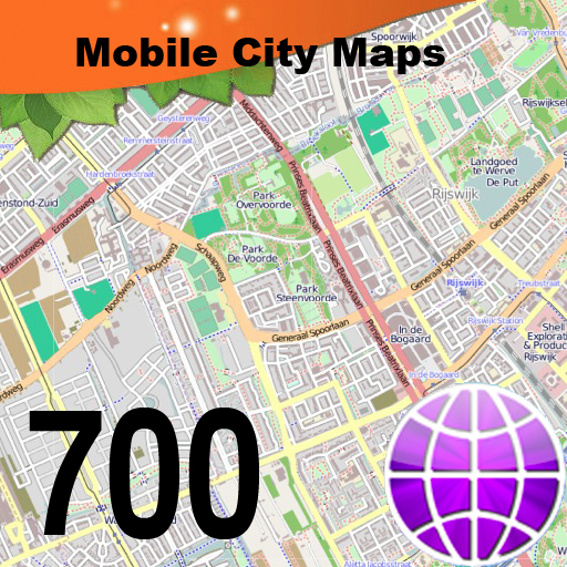
700 City Maps for you to choose from!
Do you feel online Google Maps is too slow showing you the map? Do you want an easy way to mark and remember where you are? Do you need a list of streets where you are? You don't want to carry around a big unwieldy paper map? Tired of having the paper map blown to pieces by the wind every time you try to figure out where you are and where you need to go?
The mobile streetmaps are for you! All the map data is loaded on your iPhone or iPAd before you leave your home, so can you be on the streets, offline, and still know everything about the area you are in, and locate yourself or any street in the city. You don't need any network connection at all once the application is installed on your iPhone - no WiFi, no 3G, no GPRS!
You can choose from more than 700 maps to download. All the data for each map is stored on your iPhone or iPad, so it works where you have no access to the Internet - it works where Google Maps is inaccessible. This prevents expensive data roaming charges by loading all the map data to your iPhone or iPad before you leave home. You can turn off all network functions and still be able to find your way around. Lets you find all streets, and many useful locations such as ATM's, parkings, museums, and many others. Remembers where you've been so you can find that parking spot where you left your rental car, or that great restaurant. Allows you to mark interesting locations to visit in advance.
To make sure your phone doesn't use any expensive data on your trip, go to Settings, then General, tap on Network, and slide the Data Roaming to "off". Note: GPS functions work on the iPhone and iPad 3G only, the iPod and WiFI iPad use "assisted GPS" based on nearby WiFi networks, and often know roughly where you are, but they are not as precise as GPS equipped iPhones and iPads.
We have all the major cities and tourist destinations like Paris, Rome, London, New York, Amsterdam, Bali, Hong Kong, Jakarta, Tokyo, Sydney, Venice, Barcelona, Malta, and many others, up to and including small places like Aix-en-Provence, Allentown Pennsylvania, Williamsburg Virginia, Surfers Paradise, and national parks like Yellowstone, Shenandoah, and many others. We're constantly expanding the list, and if we currently don't have the one you're looking for, tell us!
For a full list of available maps, please visit our website!
Map data (c) OpenStreetMap and contributors, CC-BY-SA.
Transit Maps
By Felt Tip Inc. released on: 2009-05-20T02:04:09Z
Transit Maps is an offline viewer for very large images. It can download maps and other large image files in PDF, PNG, JPG, and GIF format from the Internet. It is very fast at displaying complex images and it works when network access is unavailable because it slices and saves the image tiles on the device.
It comes with a sample map of the Philadelphia rail system, but you can delete it and add any maps downloadable on the Internet via the built-in web browser. Only the first page of PDF files will be saved.
This app and the included Philadelphia Rail System map are by Lucius Kwok.
Galileo Offline Maps
By Evgen Bodunov released on: 2009-07-30T01:57:25Z

Probably the fastest map application ever in the AppStore.
This has never happened before - the "Galileo Offline Maps" now support a large number of different offline maps.
[!] To use imported offline maps on your device make sure you have purchased the "Import Maps from PC" feature for $1.99 and iOS 4 installed.
It's as simple as one-two-three:
1. Download the "Mobile Atlas Creator" desktop application to your computer from our site.
2. Create an offline map you want to browse offline.
3. Upload it to "Galileo Offline Maps" through iTunes and enjoy!
(For more details please go to http://galileo-app.com/guide.html)
You can also browse online maps with the "Galileo Offline Maps".
Here's how it works. While you are browsing a map online, all recently viewed map images are saved in the cache. Thanks to this you can browse this map again without an Internet connection, even while your iPhone is in the flight mode.
Take our word, with Galileo Offline Maps you will never get lost!
We love your feedback so feel free to contact us directly via email (info@galileo-app.com) or say it out loud at http://idea.galileo-app.com.
GPS on all maps - Maprika puts \you are here\ sign on any map: ski resort, park or campus map
By Maprika released on: 2010-12-11T12:27:50Z
The best mapping solution for the places where street maps don't work well: ski resorts, parks, or campuses.
Maprika uses GPS to put "You are here" sign on the real ski resort maps, just like the one you can get at the ticket window. Getting ready for a weekend of skiing or snowboarding with friends? With Maprika, you will not get lost in snow! You can see where your friends are and easily meet them for lunch.
More than four hundred ready-to-use maps are already available for free download from Maprika: all major Tahoe, Colorado, Utah and East Coast ski resorts, European Alps and much more. To name a few, we have Squaw, Mammoth, Whistler, Vail, Aspen, Breckenridge, Killington, Stowe, Stratton, Chamonix, Zermatt, val D'Isere, Verbier. Many university campus maps are also available.
We keep adding maps to our collection. Still don't see the map you are interested in? With Maprika for iPhone, you can make the map yourself. You can even draw a map on paper and take a picture of the drawing! Once you've added GPS anchor points to the map, upload it to our server and share with the Maprika community.
Going to a place with expensive roaming or no cell phone coverage? Maprika maps stay in the phone memory and will be available anywhere, regardless of internet connectivity. Just remember to download them before you leave!
Visit www.maprika.com for the full list of maps, video tutorials, or to request maps.
Note: Maprika can be configured to track your location in the background. Continued use of GPS running in the background can dramatically decrease battery life.
Mexico - Offline Map
By Ignacio Z. released on: 2010-09-03T07:00:00Z

This application provides you with offline maps for MEXICO with features such as searching and ROUTING without the need of an internet connection
Note: the map is taken from www.openstreetmap.com which is the wikipedia of map and if you find any errors in it, you can fix it going to the openstreetmap webpage!
Why Offline maps?
It allows you to extend your battery life and lets you save from paying expensive roaming charges when traveling.
Why TRUE offline maps? Because it is the only application for the iphone that will allow you to have
"t"u2713"t(Full Version) unlimited city downloads (you can download ANY city in the world and more: you can download part of a city, or even country side). The current zoom available is enough for cities, not entire countries... Though I will be adding the option to append new maps to existing maps in order to have much larger areas!
"t"u2713"toffline routing for any place you download. It doesn't preload routes, but calculates them without the need to be connected to the internet.
"t"u2713"toffline places of interest (POI) for any part of the world. You don't need to buy additional packages to get POI, everything is there when you download it.
"t"u2713"toffline search: search for street names and places (house numbers coming soon).
"t"u2713"t(Full Version) collaborative mapping: You can add new places of interests and share them with the world! You can also help improve the map, it"u00b4s fun and somehow it feels good.

There are more than 300,000 iphone/ipad apps for just about any category you can think of including Offline Maps you looking for.
We belive for every paid Offline Maps app out there there is a equivalent free Offline Maps app that can be downloaded from itunes free of charge. If you do not like that app you can always uninstall it without paying for it or worring about losing the money you paid for app you do not use.
Try out the free Offline Maps apps to see if you like it before purchasing the more expensive versions of it.
- There are thousands of iphone developers daily release free iphone apps.
- Explore different Offline Maps apps with free iphone apps and see if you like it before you pay for it.
- Just like trial software for non mobile operating systems, free iphone Offline Maps apps let you explore similar tools before you purchase the more expensive version.
- For those of you looking for particular Offline Maps app specific to a professional decipline search apps by Apps Popular Among Professions.
Offline Maps Apps Users Comments